
Thirty into 1.4 million equals one Tamahunga local board

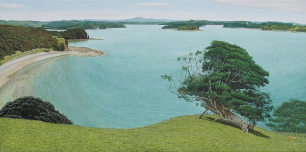
Front Runner: Mount Tamahunga, at 437 metres, dominates much of the northern ward of Rodney district, making it a top contender for the name of the area’s likely new local board. Mount Tamahunga detail, Mahurangi. Artist: Philip Kilmore
It was an unimaginable scenario in 2007, when the Labour-led government determined it was time to fix Auckland.
That in 2009, a National-led government, and Act Party minister of local government, would be remedying royal commission recommendations deficient in grassroots structures.
In fairness to the Royal Commission on Auckland Governance, its recommendations do heavily emphasise the local in local, as evidenced in its brief for the new-style local councillors:
The councillors serving on the local councils will have a more local, place-based perspective than the councillors on the Auckland Council. They will be highly focused on community engagement, and will need the trust and respect of their communities in order to fulfil their roles effectively.
The commissioners, who noted that the new council would have the statutory authority to create additional community boards over time, will presumably be entirely happy that the government has decided install, at the outset, what it is calling local boards. It was largely the goal of implementing the reforms by the next local government election date, 9 October 2010, that saw the commission opt for the expedient of recycling the existing structures and boundaries, rather than recommend either of the 11 or 20-local-council options it also examined.
The northern ward of the soon-to-be disbanded Rodney district has a population of a little over 20 000. If, as indicated, the government provides for about 30 local boards, each would have an average population more than double that 48 500, assuming 30 local boards and a regional population in 2010 of 1.46 million. But that would not necessarily rule out a Tamahunga local board. Great Barrier’s population is about 850, and the royal commission is unequivocal about the need for a community board there, similarly on Waiheke Island with its population of less than 8000. Many urban local boards, on the other hand, will serve populations greater than 48 500—Manurewa Community Board represents more than 77 000 people. The government has stated that the boundaries of the local boards will be determined by the Local Government Commission.
In its submission to the royal commission, Auckland City Council suggests ‘a menu of options for action at the neighbourhood level.’ If adopted, this would have allowed, for example, Wellsford and the other communities north of Mount Tamahunga to have their own distinct arrangements. The Auckland city model for local governance is by far the most sophisticated—it made the regional council’s effort look unimaginative. It is particularly impressive, given that the council’s first draft advocated dispensing with community boards altogether. This precipitated a councillor revolt, and the production of the second, superlative, effort.
Councils tend to discourage the establishment of community boards—Rodney has resisted years of prodding by councillor Wayne Walker on the subject. That other RDC, Rotorua District Council, is no exception. In 2005 it turned down a valid proposal to constitute a Rotorua Lakes community board, signed by 646 registered electors. The decision was appealed to the Local Government Commission. The commission upheld the appeal and provided for the Rotorua Lakes Community Board to be formed, for a population sporting little more than 2500 voters.
In its remaining year and a half, the regionally recalcitrant Rodney District Council has the perfect opportunity to redeem itself, by re-focusing on the needs of its communities. The out-going council is in an authoritative position to advise the Local Government Commission in regard to the local board boundaries that would best reflect existing and emerging communities of interest. For example, as alluded to above, the Tamahunga Range separates distinctly different communities. This suggests that separate local boards might better serve the place-making needs north and south of the Tamahunga divide.
Either way, plenty of work here to ensure the best is made of this unprecedented opportunity to forge a purposeful and cohesive region, of purposeful and cohesive communities.
Postscript In the royal commission’s recommendations there are interminable references to Auckland’s population, but nary a mention of the current population count. In such circumstances, Wikipedia can generally be relied on. For a refreshingly generous endorsement of Wikipedia, see Observer writer John Naughton’s Rule Britannica Strikes Again as Encarta Falls.