
Te Muri acquisition key to coastal trail

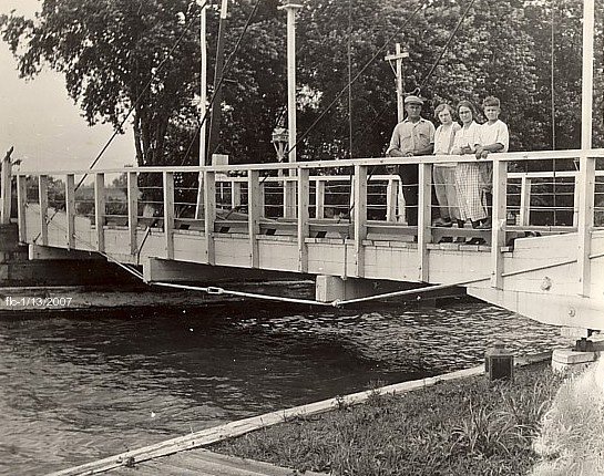
Not the Pūhoi Pivot Bridge: Lacking an image of the bridge that once formed part of the highway past Pūhoi, this on the Chesapeake and Delaware Canal is of a similar era. image courtesy Jeanne Harmon
It was to have formed part of a scenic coastal road. In 1973, when the regional councilthe then Auckland Regional Authority secured 63.8 hectares of coastal land at Te Muri for that purpose, such car‑centric thinking went unchallenged.
Subsequently, the regional council’s ardour for the coastal road connecting Mahurangi West and Wenderholm cooled, replaced by plans for a road to extend from Ngārewa Drive, across Te Muri estuary to a 4000-car parking areaalso remembered as a 2000-car parking area.
In 1986, a small drilling rig began a geotechnical investigation for the long concrete bridge that would have been required to cross the estuary. Local plumber Peter Broughton blew the whistle—at the time, he was working on the 1875 Sullivan villa. Mahurangi West residents, who had grown inordinately fond of ‘their’ car-free Te Muri, swiftly took up the cause. Locals had discovered early what 22 years of visitors have found since the park was formally opened: The gentle walk to beach from the end of Ngārewa Drive provides a delicious sense of isolation, out of all proportion to the ten-minutes invested.
The park management’s plans were vulnerable, in that consent had not been obtained from government for a navigable waterway to be impeded, by the proposed bridge. Locals staged a sail-in emphasise the point.
Refusing to discuss the issue, regional parks department manager Philip Jew determined that the road, bridge and parking would be addressed as part of the upcoming park management plan process. The attempted deflection played into the hands of those opposing vehicle access, when the Mahurangi West residents group put together a comprehensive plan for Te Muri to be developed for walking access only. Te Muri Estuary: Suggestions for the Mahurangi Regional Reserves turned the heads of the Citizens Advisory Group, chaired by Judge Arnold Turner. The advisory group, the use of which has long-since been discontinued, had the first, and effectively the last, say.
While victory hadn’t been immediately apparent, a categorical assurance was eventually extracted. Mr Jew, however, was clearly miffed at having been pressed for an unambiguous statement:
Please be assured that the Authority will implement the management plan with credibility in its customary manner and will ensure that the positive aspects of the plan are acted upon rather than the perceived ambiguity which seems to be causing such concern to your organisation in regard to road bridges over the Te Muri Estuary or the Pūhoi River.
Although the specific wrangle over wording regarding road bridges was resolved, all efforts to have the plan record the community campaign for vehicle-free access were rebuffed. The danger, the campaigners insisted, was that vehicle-based access could be considered again sometime in the future, in ignorance of the community discussion that led to the rejection of the road bridge. No one then imagined that the threat would come two decades later, with the acquisition of the balance of the Schischka property.
Central to the vision outlined for Te Muri was a coastal walkway:
An unspoiled inlet and uncrowded beach nestling between two popular parks. Walkers, having crossed the renowned Wenderholm walkbridge, pausing to enjoy this haven within a haven.
Te Muri is a short walk from Wenderholm, but for the means of crossing the Pūhoi River. The 1987 submission suggests:
a high clearance walkbridge, sympathetically designed, would be a feature in itself and substantially cheaper than the intended Te Muri Inlet roadbridge.
Later submissions continued the call for a Pūhoi River crossing, but backed off the ‘high clearance’ approach that would have been necessitated had the bridge been positioned off the end of the spit—in order to clear the masts of craft entering the river mouth. Instead, the spirit of the historic Pūhoi River pivot bridge was invoked, in a location farther upstream—including to allow lofty vessels room to await the pivoting span to be swung open.
With the purchase of the balance of the property—383-hectaresas published 2011: 407 hectares—the instinct is to develop the park primarily for access by private car—the pattern established at the inception of the regional parks programme. At Te Muri, parks planners have the perfect opportunity to break out of this mould. Te Muri, potentially, connects Mahurangi Regional Park with Waiwera, and public transport.
A weakness in the region’s otherwise exemplary park network is its inaccessibility to non-car users. Aside from the clear and present imperative to use forms of transport that generate less greenhouse gas, it is socially unconscionable to disadvantage those who rely on public transport.
The issue is easily resolved in respect to Te Muri and Mahurangi West parkland, by the building of a coastal cycle trail. Trails that provide access to areas not accessible by road prove to be deeply rewarding, and highly popular. And where they also traverse a coastline, the combination is irresistible.
There is, however, an even more fundamental reason to resist the reflex to provide road access to Te Muri. From the Waiwera River to Scotts Landing almost to Martins Bay and out to Motuora is a maritime park of national park proportions. Prior to European settlement, and until the 1930s, access was by water. A ferry service across the harbour and out Saddle Island and Motuora would weave the disparate pieces of a greater Mahurangi Regional Park into a whole that is greater than the sum of the parts. But even without a cross-harbour ferry, Waiwera River to Ōpahi via the shoreline is some 10 kilometres—a significant coastal walk, or cycle, all within regional park.
Having cost Auckland Council $15 million, the pressure is on to demonstrate the purchase was justified. Forming the secluded heartland of a 750-hectare (including islands) Mahurangi maritime park, the Te Muri purchase could be key to making the whole work as one, with coastal trails and connectivity by the sea.
The Schischka family will continue to farm the property for the next five years. This provides ample time to develop a holistic vision for the Mahurangi, Motuora, Te Muri and Wenderholm public estate, and ample time to consider, plan and build a Mahurangi coastal cycle trail.
Connectivity by the sea Following the demise of the Scotts Landing wharf, and until it lapsed during World War Two, the Mahurangi Regatta prize-giving and dance was held at Waiwera, thanks to its wharf still standing. Mahurangi epitomised connectivity by the sea.
Locals in early Mahurangi Regional Park farm manager Peter Baker, through his sympathetic decision to allow locals access to Sullivan Bay and Te Muri long before the park was developed and opened for visitors, produced a batch of park users that valued the sense of remoteness experienced where cars are kept a little at bay.